
The cloud Congleton
The cloud Congleton is a great starter hike for little legs. My kids love this short walk which we have been doing since our youngest was just 4 years old. It’s one of our favourite Child-friendly walks in Cheshire. Find more Family walks North West here.
Why do we love it? It 1-1.5 miles, 1.6 – 2.4 km (depending on the route you choose) from Timbersbrook Car park (and picnic area) to the summit. Parking is free. There are spectacular views of cheshire (but occasionally you’re literally in the clouds! So pick your day). It’s a lovely family walk throughout the seasons too.

Where is Bosley Cloud?
The Cloud is one of the highest hills in Cheshire and is located on the border with Staffordshire. It’s not far from Congleton and Macclesfield. It is 343 metres (1,125 ft) in height and the views at the top are amazing across the Cheshire plain and the Peak District. The path up The Cloud is part of the 35 mile long Gritstone trail.
Where to park for Bosley Cloud walk?
There is a free car park for this walk – Timbersbrook car park. The car park is free and managed by East Cheshire council. It is open by 9.00am each day, and closes at 5pm during the winter, and 8.00pm during British Summer Time. Postcode is CW12 3PP, it’s located on Weathercock Lane in Timbersbrook. It is signposted off the A54 Buxton Road. We find it easily by searching for Timbersbrook car park in google maps. There are no facilities in the car park or indeed on the walking route.
There is also some on-road, free parking on Tunstall road.

Where is the picnic site in Bosley Cloud?
Right next to Timbersbrook car park is Timbersbrook picnic site. You exit the car park via the pedestrian access path which is also part of the Gritsone trail. There is a large grass area and a number of picnic benches. There are also a few boards and signs up about the wildlife you could spot.
If you’d like to enjoy your picnic with a view at the top of The Cloud, there are no picnic tables as I’m sure you’d expect but there are plenty of flat rocks to sit on.

Is The cloud walk pram-friendly?
No, it’s steep, the ground can be rough and rocky in places and just generally not suitable for a pram or pushchair. If you are looking for more suitable walks, you need this post – pram friendly walks in Cheshire.
How long is the walk up to the top of Bosley Cloud?
Depending on the route you take to the top, the distance from the car park can be as little as just over 1 mile. This makes it a really achievable walk for families. It takes us about an hour to get to the top with young children so you might find it takes you a bit more or less depending on your walking speed. The walk to the top is all uphill with varying degrees of steepness.
The views across the Cheshire plains in all directions on a clear day are stunning. You can see Jodrell bank on a clear day. There is a great view finder that shows you what you might be able to spot in each direction.
Bosley Cloud walking route
Summary
Start and finish – Timbersbrook car park
Approximate duration – 2 hours (this is just a guide, everyone walks at different paces)
Distance – approx 2.5 miles
Accessibility – This is not an accessible walk, it’s steep, the ground can be rough and rocky in places and just generally not suitable for a pram or pushchair
Public toilets – none
Other Facilities – none
From Timbersbrook car park look for the footpath in the far right corner. Follow the path through the picnic area and up the approximately 30 steps to join Tunstall road.

When you meet the road, turn left up the hill. You now have 2 options. Your first option is just 150 meters from up the hill where you will see a turnstile and the steps on the right hand side of the road. The path is sign posted as Gritstone trail. There are 135 steps and my kids actually enjoy this part of the walk. At the top of the steps, you join the track option, turn right and the route continues.


If you don’t fancy the steps, walk slightly further (around 175 meters) up the main road to avoid them altogether by walking up a track which brings you back to the top of the steps. From here continue straight up and the route below is now the same for everyone.
Follow this path straight on. You’ll pass a brown gate on the right which is a private drive and on the left is a small cave like area. The path you want is in the middle.

A bit further and the path splits. You want to take the left hand path which clearly goes upwards and there are a couple of signs letting you know this is the Cloud walk (including a National Trust sign post).

It’s worth noting at this point that The Cloud is jointly managed by the National Trust and Congleton Mountain bikes club. There are a number of routes just for bikes and these have posts with a symbol of a biker on them and also of a pedestrian with a line crossed through it to show these are bike only. You do pass the occaisional bike on some of the main paths.
After around 80 meters, you will reach a t-junction, turn left and follow the path up hill. You can start to see some of the stunning views from this point.

The path curves round to the right and will bring you to a wall with a small gap in it. Pass through the gap and you now have 3 paths in front of you. The left and middle one both take you to the top of Bosley Cloud.

We always take the left-hand option up and come down the middle path. The middle path is slightly shorter and possibly a bit easier so you could choose to just go up and down this path if you prefer. In which case simply follow this path straight up until you reach the summit.
If you choose to follow the left hand path, you will be rewarded with stunning views along the way, “a den” in some trees and a little rocky/scrambly bit. Don’t let the last bit put you off, my kids love it and manage easily. If you stick to the main path you’re never near to the edge which I know is a worry with young kids. Don’t let them run too far in front of you but so long as they stick to the sign posted Gritstone path you’ll manage.


Once at the top, you’ll find the trig point and the view finder tile.


Once you are ready to return to the car park, the middle path is directly behind the view finder and it will take you down through woodlands until you rejoin the main path where you started and then follow the same route back down to the car park and picnic area.


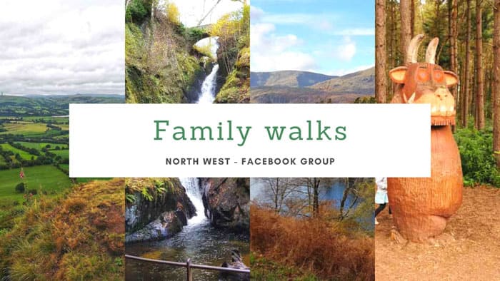
Enjoy family walks? Join the Family Walks North West Facebook group to be part of a community sharing the best walks for families across the region. Join here.
Nearby places to visit
Fancy another great family walk? Have a look at this Teggs nose walk which isn’t too far away.
A little further away but a fantastic family hill to clime is Old Pale Hill.
Glebe Farm Astbury is a great free (or low cost if you want to feed the animals or have a tractor ride) children’s farm to visit.
Find some pram friendly walks Cheshire here.


